With the sign “Welcome to Alice Springs” disappearing in the side mirrors, we were nervous about the adventure that lay before us. The Tanami Road had a reputation as being a formidable track that led from the Stuart Highway to Halls Creek in WA. My 9-year-old son, James, and I were putting our faith in the 80 Series Landcruiser towing a Tanami off-road camper for over 1000km of remote country, would we make it?
In May 2022, with my son now living a life of his own, I stopped to capture an image of the Tanami Road sign and as much as my vehicle had changed in sixteen years, so had the sign and the amount of bitumen. The road reports had all said that the first 150km of dirt was the worst, so that was something I was itching to find out.
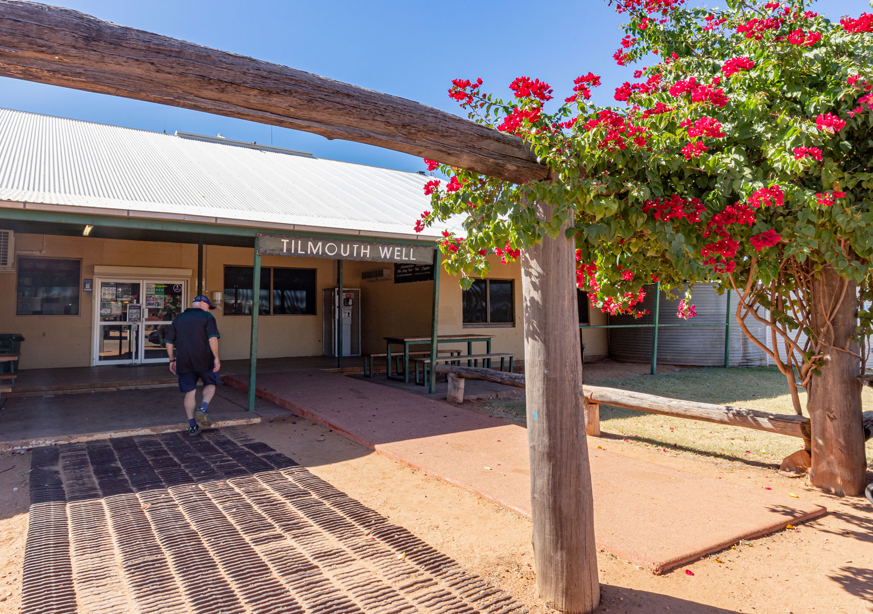
This time, Tilmouth Well Roadhouse, 136km from Alice Springs, was the last stop for fuel until Halls Creek, more than 860km away. Back in 2006, the single lane bitumen strip ended at Tilmouth Well and then the roughest stretch of corrugated road we’d ever encountered, began.


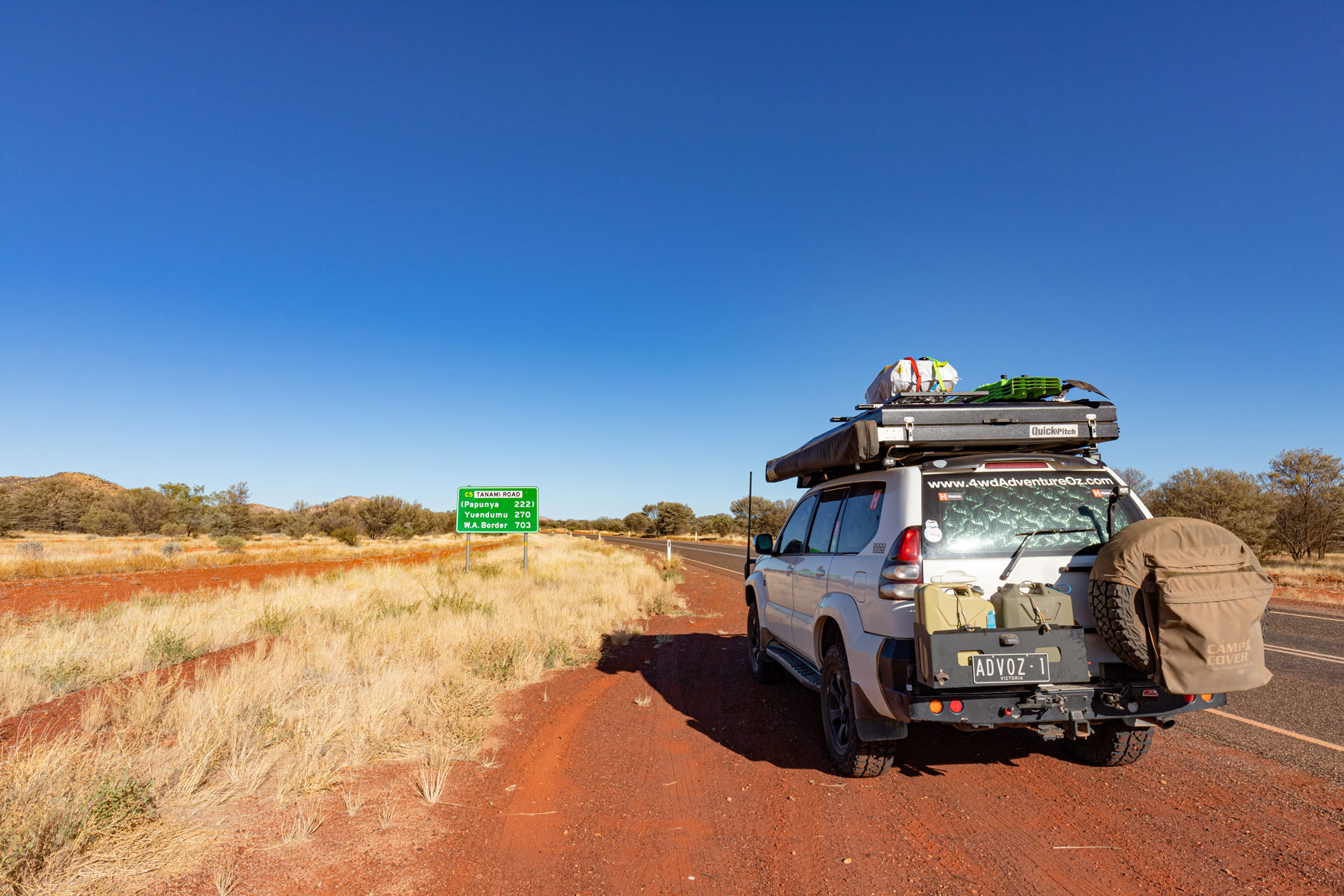
The risk of coronavirus spreading to Aboriginal communities in the NT and WA was keeping them closed (as at the time of writing). This meant I couldn’t access Yuendumu for fuel or to visit the renowned Warlukurlangu Artists that is packed full of outstanding and colourful Aboriginal art. Typically, you can enter without needing a permit to access fuel and the art studio. It was just past the turnoff to Yuendumu that 270km of bitumen finally ended.
On both occasions, the ruins at Mount Doreen were unfortunately missed, the first time because I didn’t know about them and the second time as I encountered a road train heading south and a convoy of vehicles heading north at the same time as passing the turn-off. From what I’ve heard, it seems to be a good spot for an overnight camp.
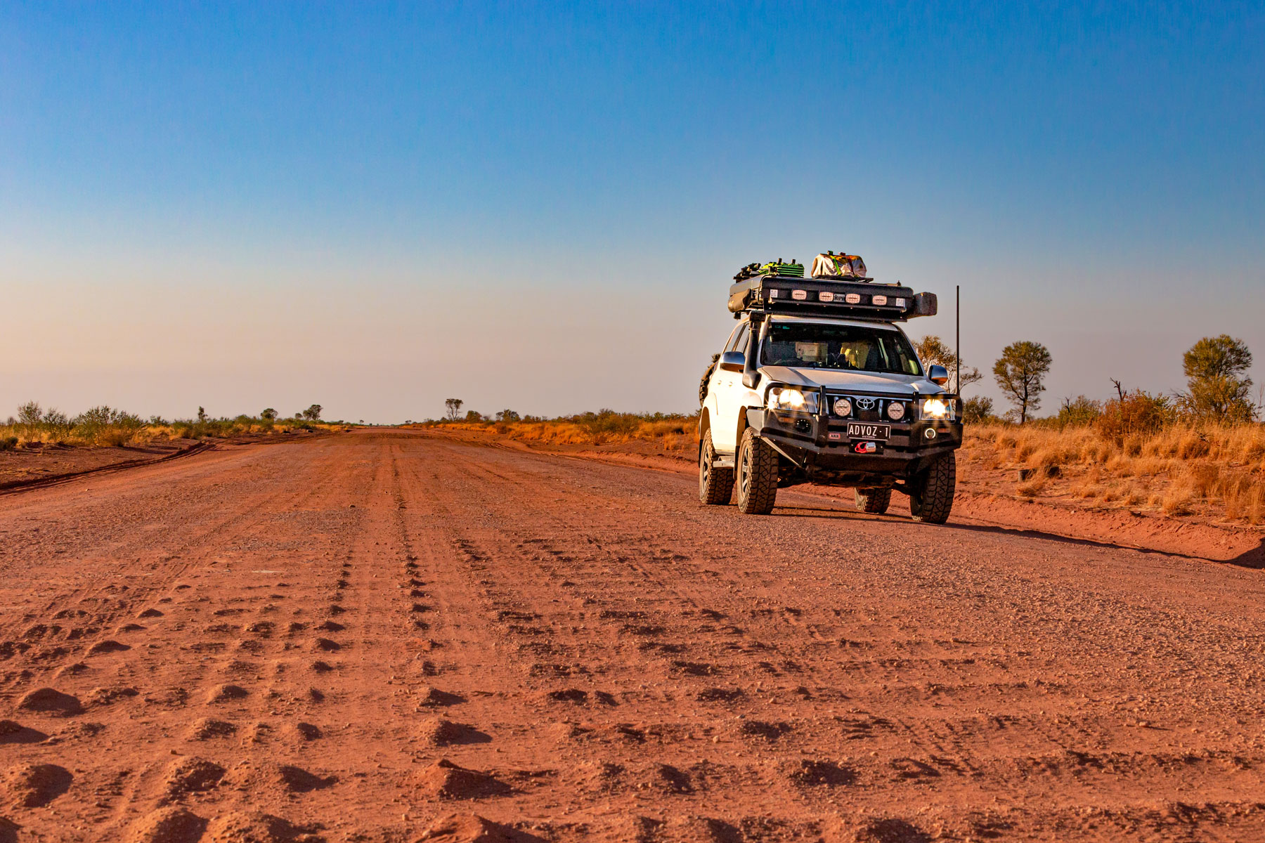
My memories of the corrugations resurfaced as the road became rougher and I was glad that my Prado was running lighter now. I was running at 18PSI in the front tyres and 22PSI in the rears and still, it was tough to find a rhythm or the right line to take. Trying to slow to a stop for a photo and then speed up again to try and get on top of the humungous corrugations was madness.
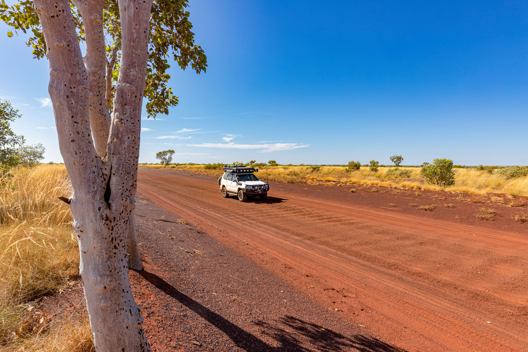
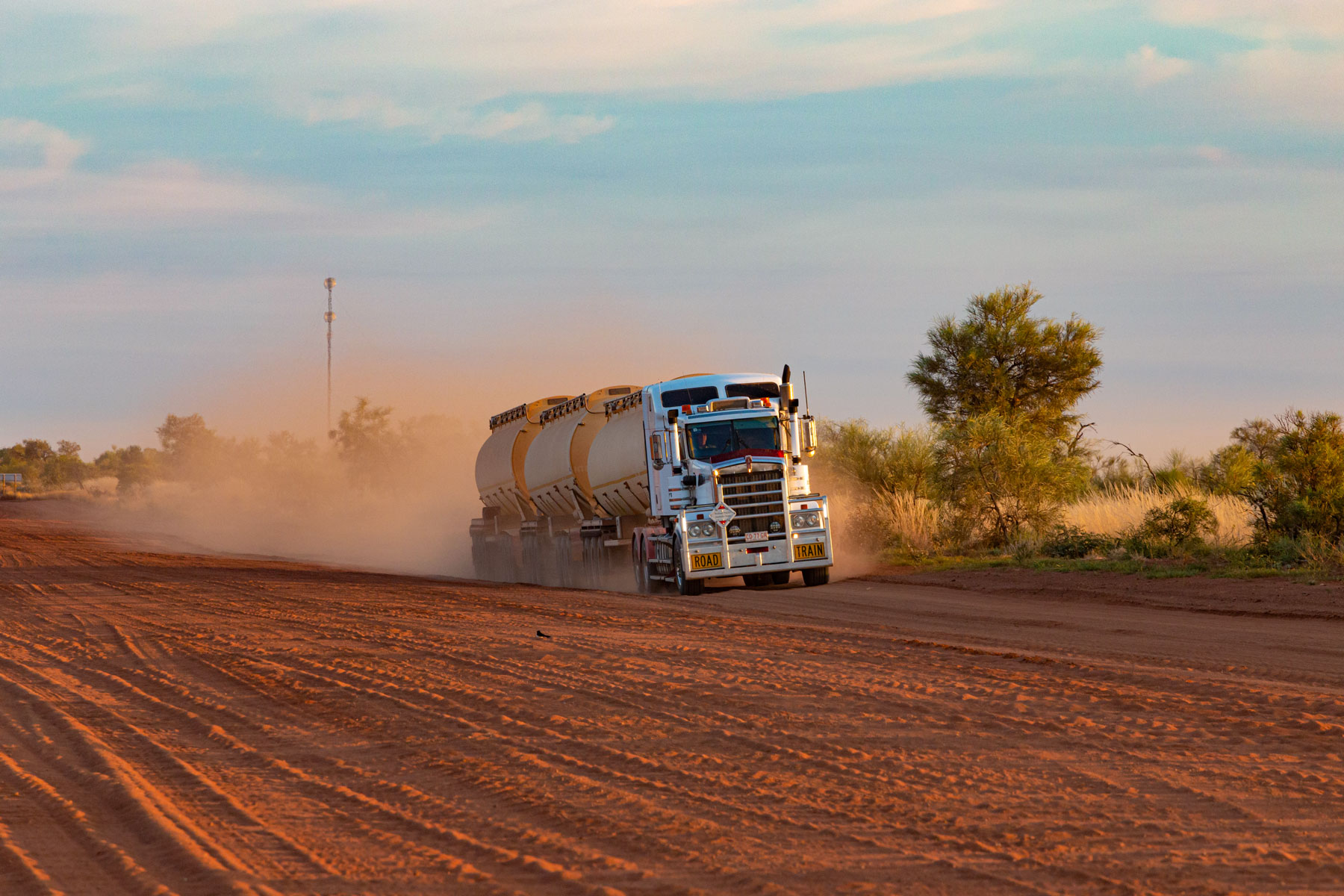
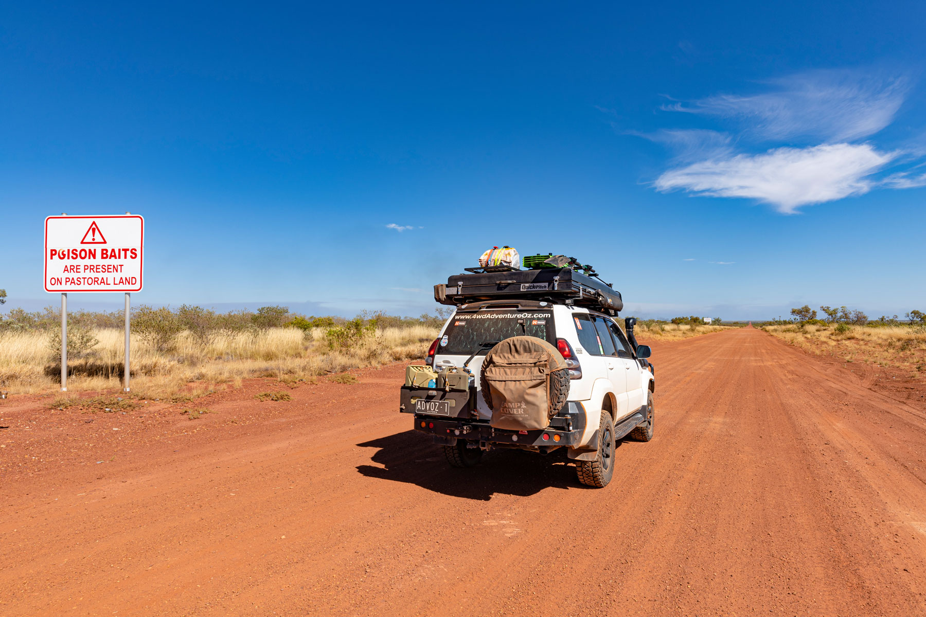
I felt for the truck drivers servicing the mines. They top out around 20kmh with dust flying and trailers rattling it’s a tough gig and understandable that they dislike this route. They are great though as they move out of the way to let you pass and most even move to the side of the road that the wind is blowing to so the dust doesn’t envelop your vehicle.
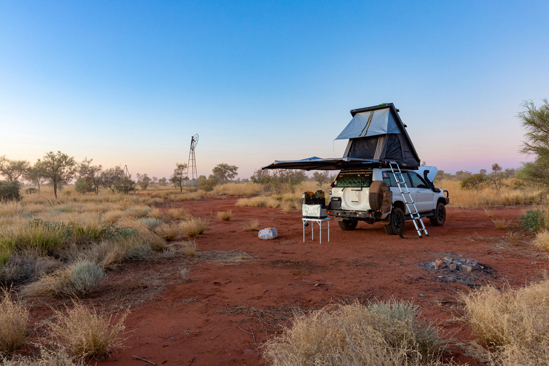
After what seemed like a long day on the road, I pulled into the roadside stop at Renahans Bore and followed a track that led to some good open spaces for camping. It’s wise to get as far away from the road as possible as the trucks run from dawn to past dusk, so dust is always in the air. There must have been some water in the disused bore as the flies were plentiful and very sticky. It was just after dusk that I could start cooking dinner without having the little buggers crawl all over me.
I was trying to work out how James and I were able to reach Rabbit Flat Roadhouse another 150km up the road in one day, we must’ve really pushed it. That 80 Series was an excellent touring vehicle though, and tough as nails. I recall arriving at Rabbit Flat to find what looked like a building after the apocalypse. Thick cinderblock buildings with metal shuttered windows, I was greeted by Bruce Farrands as he slid back a solid window.
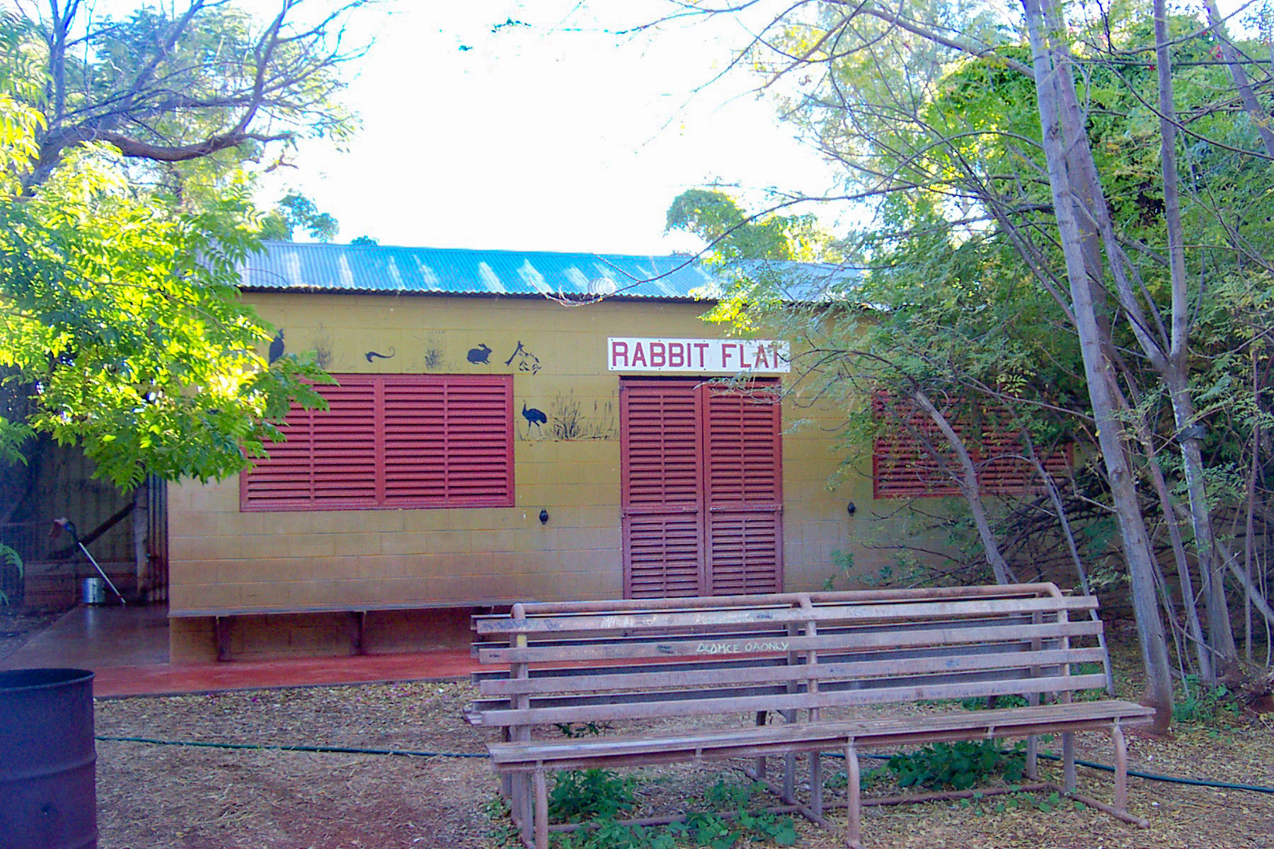
It was uneasy to see the rifle by his side and a pistol on his belt, I’d heard rumours about how wild it was out here. After filling up the thirsty 80 Series, we paid for fuel and $1.20 for a night in the bush campground nearby. Rabbit Flat Roadhouse closed its doors for good on 31st December 2010.
After a solid sleep and a quick pack up, the mob of truck drivers looked surprised when I drove out, giving me a “where did you come from?” looks. Another reason why finding a camping spot out the back is better than at the roadside stop. There was no breeze to speak of in the early morning light, so the dust hung in the air making it difficult to see at times.
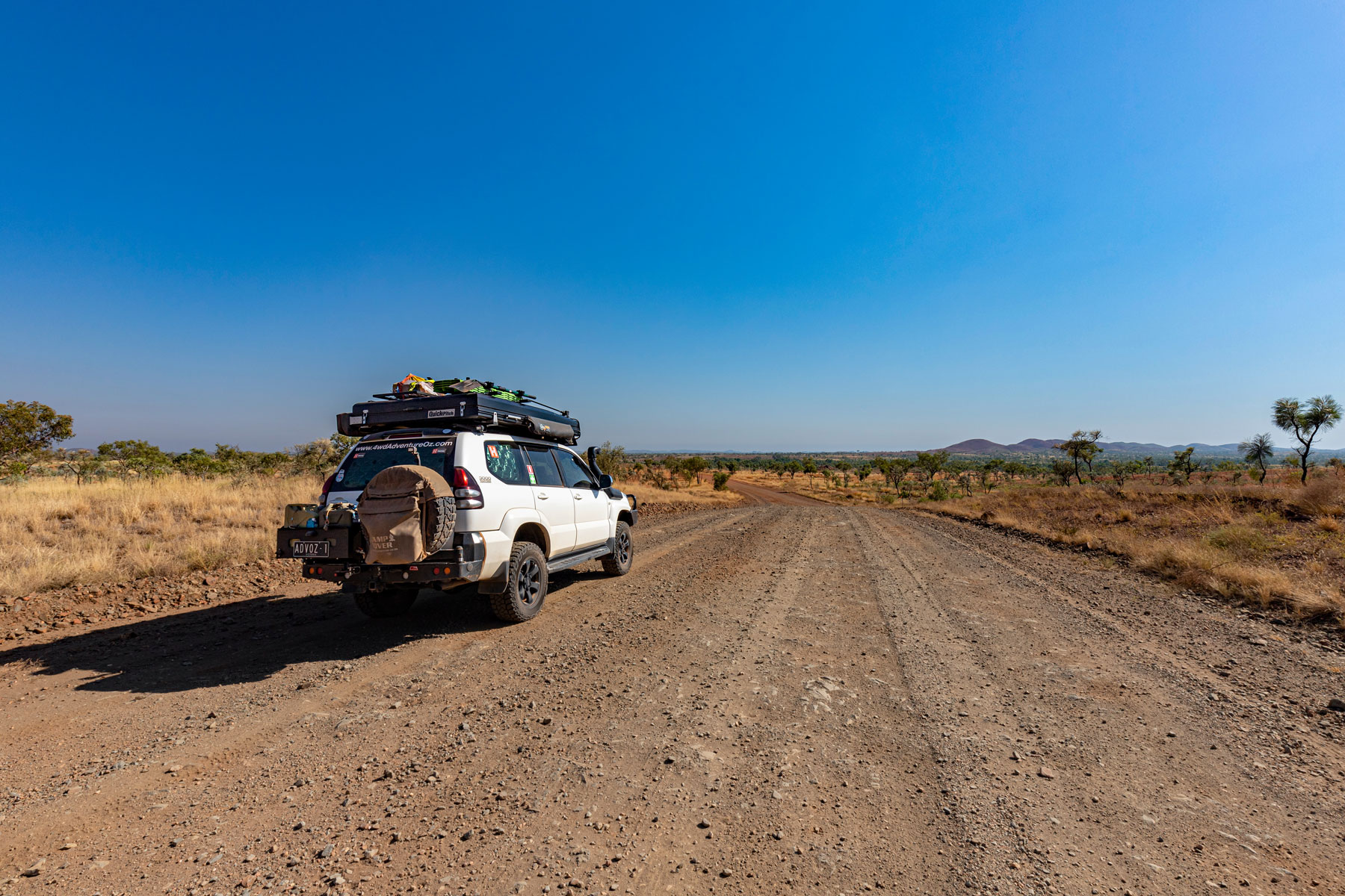
Once past The Granites mine site, the road improved with the corrugations reduced in size by at least 70%. In 2006 the track was heavily washed out after some heavy rains but in 2022, it had been improved significantly. I was soon passing the turnoff to Rabbit Flat, and the “road closed” sign was sad to see. Mind you, it would be bloody tough living out here and not something I would ever consider. The old Tanami gold mine is abandoned but you can still see some machinery sitting atop the hill and from here it’s a short drive to the border.
In 2006, James stood under the “Welcome to Western Australia” sign, which no longer exists, so are we still welcome? I did discover this time, that the border is further west than where the sign used to be. It is signified by a fuel drum painted white with black Texta on the 129th meridian east longitude (129° east).
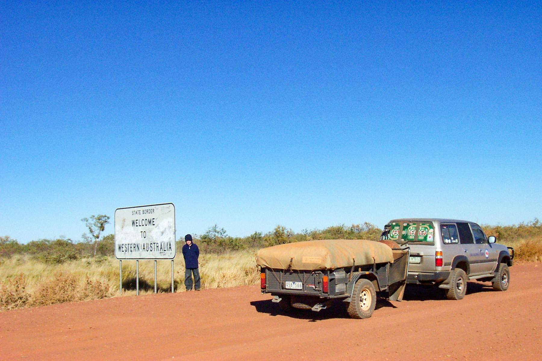
The Welcome to Western Australia sign has been replaced with this one
The dirt road is shotline straight until it reaches the Coyote Gold Mine turnoff and then straight again after a couple of turns. The road becomes rough again too with mine traffic and vehicles travelling to and from Balgo. You can’t miss the turnoff to the Warlayirti Art Centre with the pink Troopy and colourful sign.
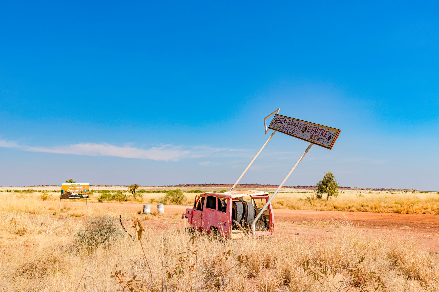
Access was not permitted this time, but besides checking out the desert art and topping up your fuel, it is from Balgo that you can take a detour off the Tanami Road to Lake Gregory and Stretch Lagoon via Mulan, part of the Paruku Indigenous Protected Area (IPA) before travelling to Billiluna via the Canning Stock Route.
Permits to access one of Australia's most significant inland wetlands can be purchased online or at Paruku IPA offices in Mulan and Billiluna. There are three designated campsites popular with birdwatchers and people who love remote camping while canoes and swimming are permitted in specific areas. As many areas within Paruku IPA hold special significance for the Traditional Owners, travellers are asked not to camp or drive outside the designated areas.
The flat terrain begins to be broken up by the Selby, Elsey and Ferdinand Hills and then you reach Sturt Creek and Billiluna. Keep an eye out for wild horses that roam the plains and if you’re with Telstra the phone will start beeping. Stretch Lagoon is approximately 15kms south of Billiluna via the CSR and permits are required. For those people travelling the CSR, this is the last fuel stop until Well 33 when heading south.
Sturt Creek was bone dry, unlike in 2006 when it had plenty of water and from the turnoff to Billiluna it’s only 41km to the sign pointing to another drawcard of the Tanami Road, Wolf Creek Crater. The track is 20km of corrugated driving, with a couple of gates to pass through, leave them as found, please.
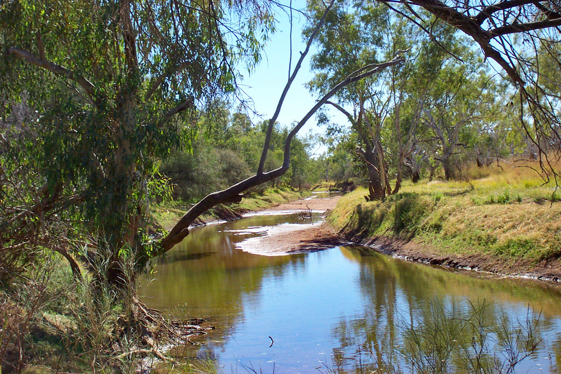
Sturt Creek in 2006
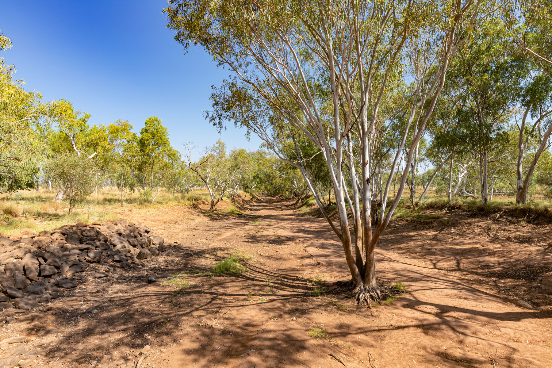
Sturt Creek in 2022
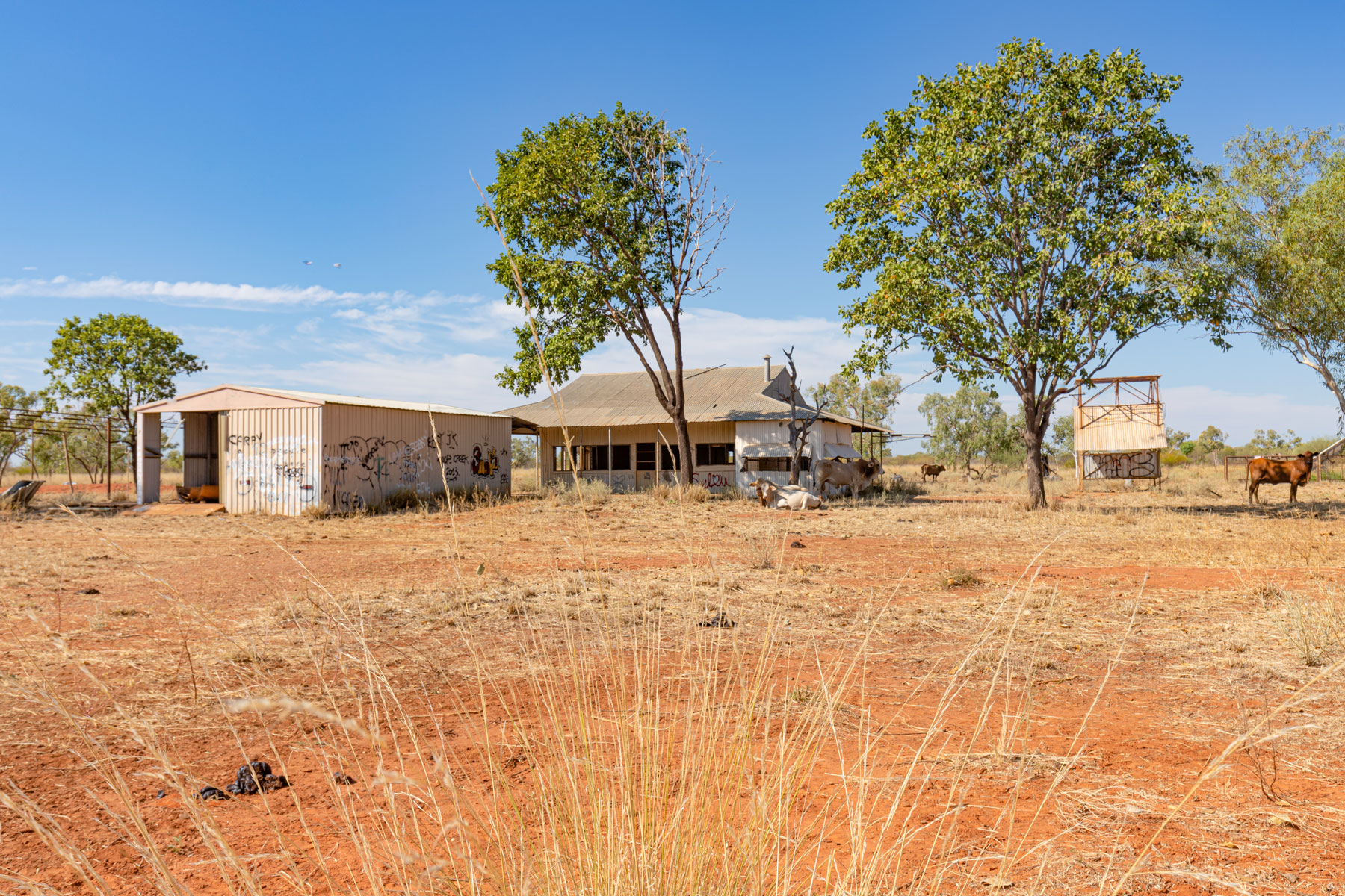
The abandoned ‘Carranya’ homestead has been made famous by the Aussie outback horror movie, Wolf Creek. I still find it hard to think that I grew up watching the main character on Playschool who then became a vicious killer. A herd of cattle were enjoying the shade around the buildings, so I couldn’t get too close, not that I wanted too anyway.
Wolfe Creek Crater is the world’s second-largest meteorite crater aged at around 300,000 years. It’s estimated that the meteorite weighed more than 50,000 tonnes and travelled at 15km per second when it punched a massive hole in the earth’s surface. The crater was probably up to 120m deep, but years of windblown sands have slowly filled the crater so that it is now only 20m deeper than the surrounding plain.
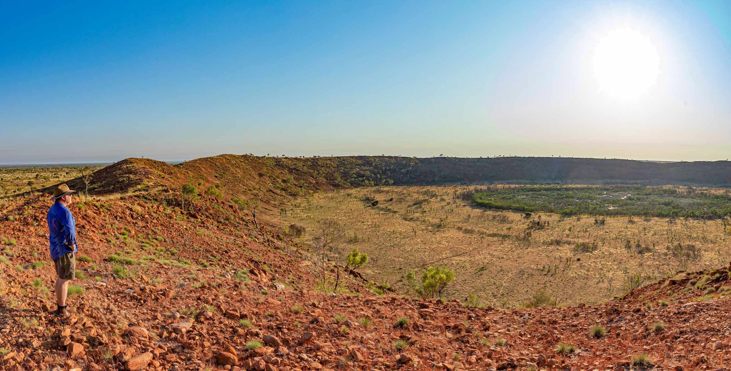
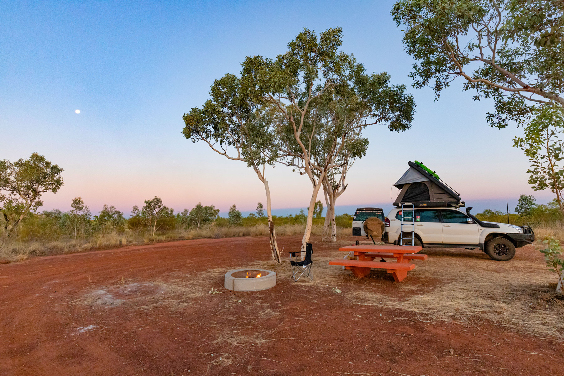
Sunrise and sunset are the best times to view this magnificent crater and it’s recommended to do the rim walk or the crater walk during the cooler periods of the day. The nearby campsite consists of drop toilets and dispersed tables and firepits. Most sites offer shade from the Ghost gums, and you’ll need to bring your water and toilet paper and take away any rubbish.
The final section of the Tanami Road into Halls Creek takes you past the ‘Ruby Plains’ homestead and then twists its way through the scenic Baily Range before intersecting with the bitumen of the Great Northern Highway. Driving into Halls Creek it didn’t look like much had changed between 2006 and 2022, except it was greener, there are mobile phones and EFTPOS machines and the cars are more modern.
While the Tanami is a great shortcut from the Red Centre to the Kimberley, some won’t think it an interesting drive, I thought that as it differed so much from 2006 it was more exciting. The wide-open spinifex plains, the burnt orange dunes, the colourful hills, granites and rocky outcrops.
There were challenges, thanks to the abhorrent corrugations with things rattling loose, lost screws and nuts. Whenever the opportunity to stop came up a walkaround took place to check and fix any issues there and then.
It was a shame that Aboriginal Communities were closed to visitors as I would’ve enjoyed checking out the local art. Even a side trip to Lake Gregory or Stretch Lagoon was an option unavailable at the time of writing. Hopefully, this will change soon so that when you tackle the Tanami Road, you can add to the adventure.
Tanami Road Travel Planner
Where: The Tanami Road runs 1051km from Alice Springs in the NT to Halls Creek in WA.
Camping: There are only a couple of designated campsites along the track (Sturt Creek, Renahans Bore, Tilmouth Well) however, there are several spots along the way where you can easily stealth camp.
Best time to visit: From April to September as the weather is generally cooler and reduced chance of rain.
Fuel: Alice Springs, Tilmouth Well, Yuendumu, Balgo, Billiluna, Halls Creek
Permits: Paruku IPA Permits can be purchased from the IPA offices in Mulan Community or Billiluna or online
Navigation: Paper maps, with the Hema Great Desert Tracks providing excellent coverage and some form of electronic navigation/mapping hardware/software such as the Hema 4x4 Explorer app or the HX-2 are recommended also.