A remote shire
In Far North Queensland, the Shire of Carpentaria abuts the south-east shore of the Gulf for which it is named. With fewer than 2000 inhabitants spread over 64,000sq km, the shire is one of the least densely populated areas in the state, remote and largely undeveloped. The lion’s share of the population lives in the shire’s two main towns: Normanton, the administrative hub and service centre on the banks of the Norman River; and Karumba, a fishing port 40km downstream at the river mouth.
The Gulf of Carpentaria
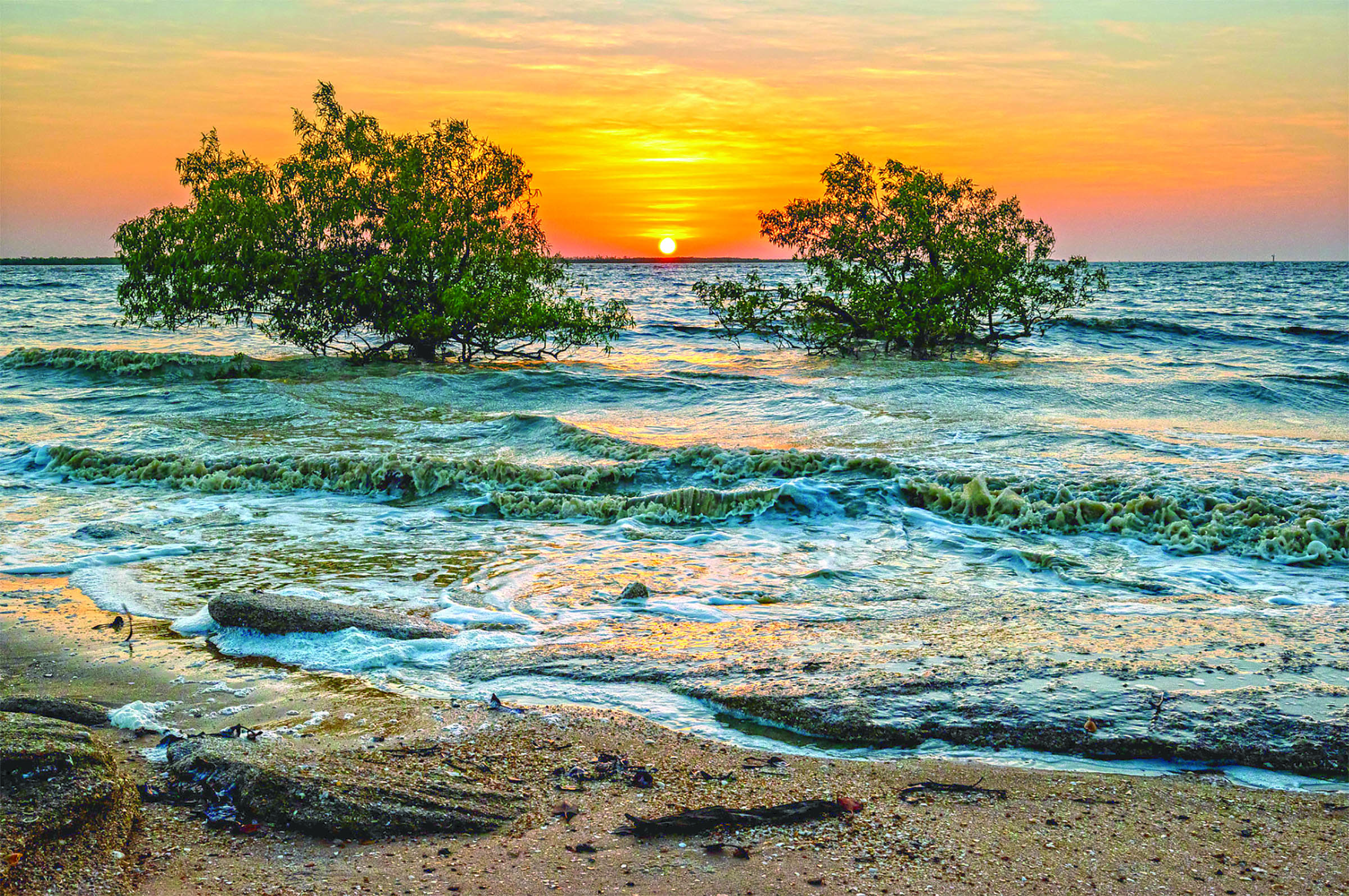
The Gulf of Carpentaria is a large, shallow sea covering an area of about 300,000sq km, opening into the Arafura Sea between Australia and New Guinea. Ninety kilometres north-west of Karumba and adjacent to the Wellesley Islands, the Gulf of Carpentaria Marine Park protects a network of submerged coral reefs that support dense sponge gardens, abundant fish and breeding grounds for marine turtles.
Shallow seagrass meadows are important nursery grounds for many fish and prawn species targeted by commercial operations based in Karumba. They also provide year-round grazing for dugongs and turtles. The estuaries and near-shore waters are patrolled by sharks, sawfish and dolphins, while the inter-tidal zones are among the most significant crocodile breeding areas in Queensland.


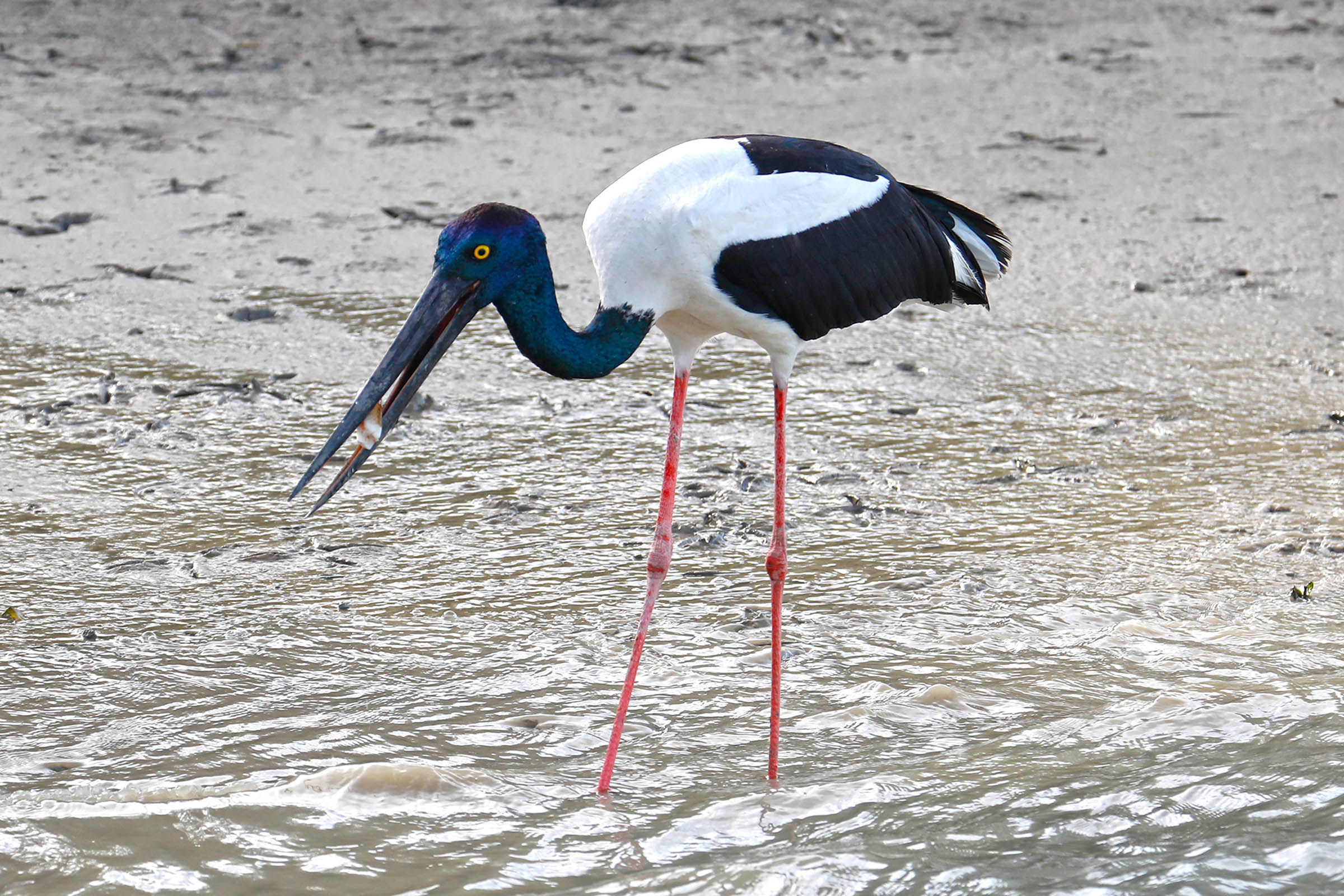
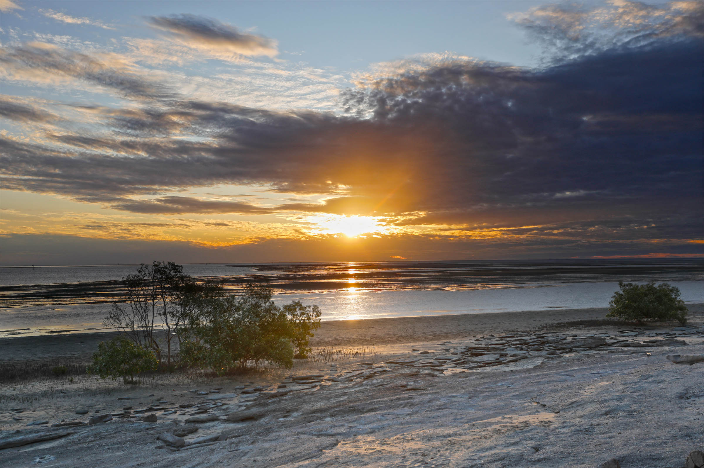
The shoreline of the south-eastern Gulf is a continuous, undisturbed littoral of estuarine wetlands, salt marshes and mangrove-fringed mudflats. These varied environments provide breeding and feeding habitats for large numbers of wading birds – up to one-third of Australia’s shorebird species – and are an important waypoint for migratory species on the Asia-Pacific flyways.
The Gulf Savanna
The land bordering the southern margin of the Gulf is known as Gulf Country, a tropical savanna of flat, low-lying plains covering 186,000sq km, from the Great Dividing Range to the Northern Territory border and south to the Flinders Highway between Mt Isa and Hughenden. It is one of the largest savanna bioregions in the world, blanketed by native grasses, acacia shrubs and open woodlands of eucalypts and paperbarks.
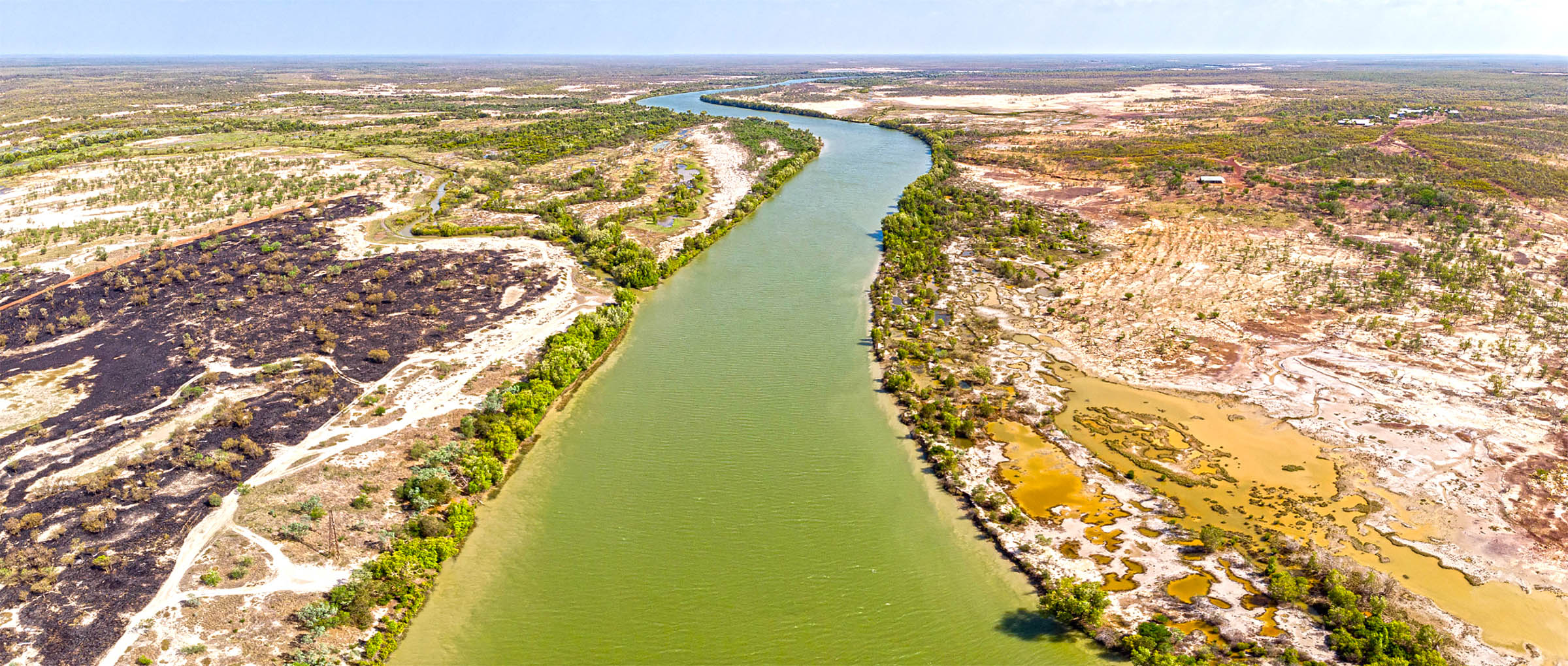
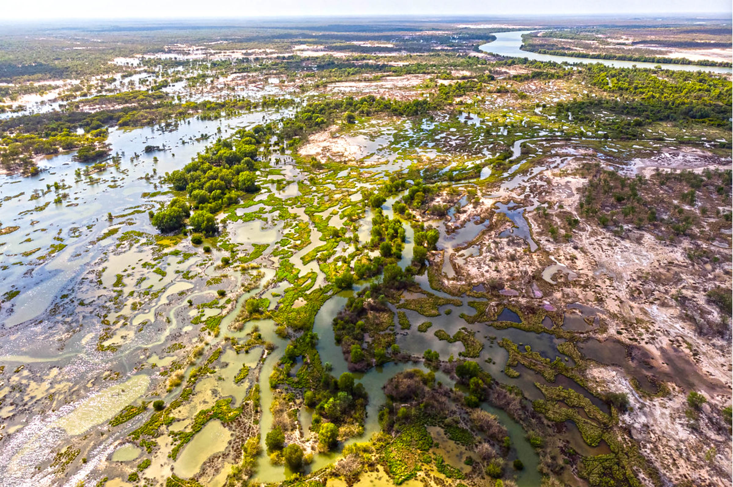
The savanna landscape is scored by many rivers, including the Flinders (Queensland’s largest), Leichhardt, Gilbert and Norman. They drain northward and many form extensive freshwater and saline wetlands along their lower reaches before debouching into the Gulf through braided channels and alluvial fans. The Norman River originates in the Gregory Range south-east of Croydon, and drains a catchment of 50,445sq km as it flows 420km to the Gulf at Karumba. During the record flood of 1974, the river peaked at 8.8m in Normanton and inundated the town.
Between Normanton and Karumba, the river passes through the 9000ha Mutton Hole Wetlands, a varied and complex system of salt marshes, sedgelands and freshwater lakes. Part of the ‘Southern Gulf Aggregation’, these wetlands comprise one of Queensland’s most important habitats and dry season refuges for thousands of waterbirds. The coast north of Karumba is also a significant staging point for as many as 30 species of migratory wading birds.
Climate and weather
The savanna plains bask in a tropical monsoon climate with two distinct seasons: a summer wet season (November-March) and a winter dry season (April-October). Temperatures are uniformly warm to hot throughout the year.
During ‘The Wet’, humid northerly monsoons sweep down from Southeast Asia, generating spectacular thunderstorms and heavy downpours that account for most of the annual rainfall – about 750mm on the coast to 500mm inland. This is the ‘green season’ when the countryside is lush, rivers are flowing and birdlife is prolific. A strong monsoon can also generate cyclones capable of dumping as much as 250mm in a single day and causing widespread flooding.
In ‘The Dry’, balmy south easterly winds deliver cloudless skies, cool nights and very little rain. Humidity is low, the countryside turns golden and birdlife is concentrated around the shrinking waterholes. This is the best time to travel in Gulf Country.
The human landscape
South-eastern Gulf Country embraces the traditional lands of the Kukatj, Gkuthaarn and Kurtijar Indigenous people who occupied the region for thousands of years before the arrival of Europeans.
The first Europeans to visit the Gulf were Dutch mariners Willem Jansz (1606), Jan Carstensz (1623), who named the gulf in honour of Pieter de Carpentier, the Governor-General of the Dutch East Indies at that time, and Abel Tasman (1644). The coast was later explored and charted by Matthew Flinders (1802) and John Lort Stokes (1841).
Ludwig Leichhardt was the first overland explorer in the area, passing through in 1844 on his journey from the Darling Downs to Port Essington in 1844. He was followed by Augustus Gregory during the North Australian Expedition in 1856.
In February 1861, Burke and Wills camped near the Little Bynoe River, 35km south-west of Normanton, narrowly failing to reach the coast to complete the first transcontinental crossing from south to north. None of the expedition party, except King, survived the return journey to the depot at Coopers Creek. One of several search parties sent to look for the ill-fated expedition was led by William Landsborough in late 1861. Landsborough explored the Carpentaria hinterland east of the Albert River and named the Norman River after the captain of HMS Victoria, which was also searching for Burke and Wills along the coast.

Landsborough's expedition report sparked an influx of pastoralists, and by 1867 a settlement was established on the site of present-day Normanton. The incursion displaced the local Indigenous people from their traditional camps and hunting grounds, leading to bitter, often bloody, conflict. Many were forcibly moved to reserves and missions, while others lived in camps on the outskirts of Normanton and Karumba. Some Aboriginal groups were moved to cattle stations to provide labour and have subsequently acquired properties and made a significant contribution to the cattle industry in the region.
In September 2020, the Federal Court made a Native Title determination in favour of the Gkuthaarn and Kukatj people over 16,500sq km of land west of the Norman River, including Normanton. In July 2022, the Court also granted a native title claim by the Kurtijar people over more than 12,000sq km north-east of the town. The rulings are non-exclusive and allow pastoralists to run cattle and operate their business on stations in the area, while the Indigenous groups have the right to fish, hunt and practise cultural ceremonies on pastoral land.
Normanton
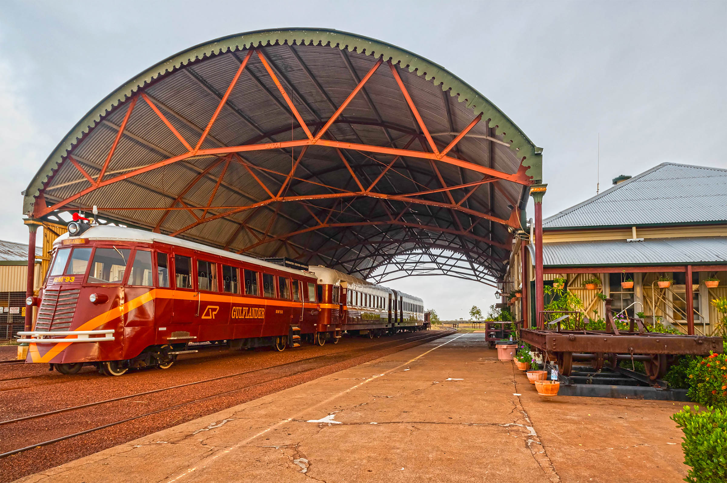
Normanton lies at the limit of navigation up the Norman River and began life as the principal port for the region’s cattle industry. It grew to prominence as the ‘Capital of Carpentaria’ in the 1890s after the discovery of gold at nearby Croydon. The town’s prosperity was assisted by the completion of the Normanton-Croydon railway, known locally as “the line from nowhere to nowhere”. The gold boom was short-lived and by the 1900s Normanton's population had dwindled significantly. In the 1960s, Normanton had a resurgence of popularity as the ‘Gateway to the Gulf’ with the development of prawning as a major industry at nearby Karumba.
With more than 200 cattle stations scattered across the Gulf Country, pastoralism remains Normanton’s economic mainstay, but tourism has become a growth industry for the town. Recreational fishing, especially for barramundi, is the most popular activity, facilitated by ready access to the river from the council-operated boat ramp and wharf or the Captain WH Norman pedestrian bridge (aka the Fred Pascoe Community Fishing Place). Local shops sell all the necessary gear and charters are available for those who don’t have their own boat.
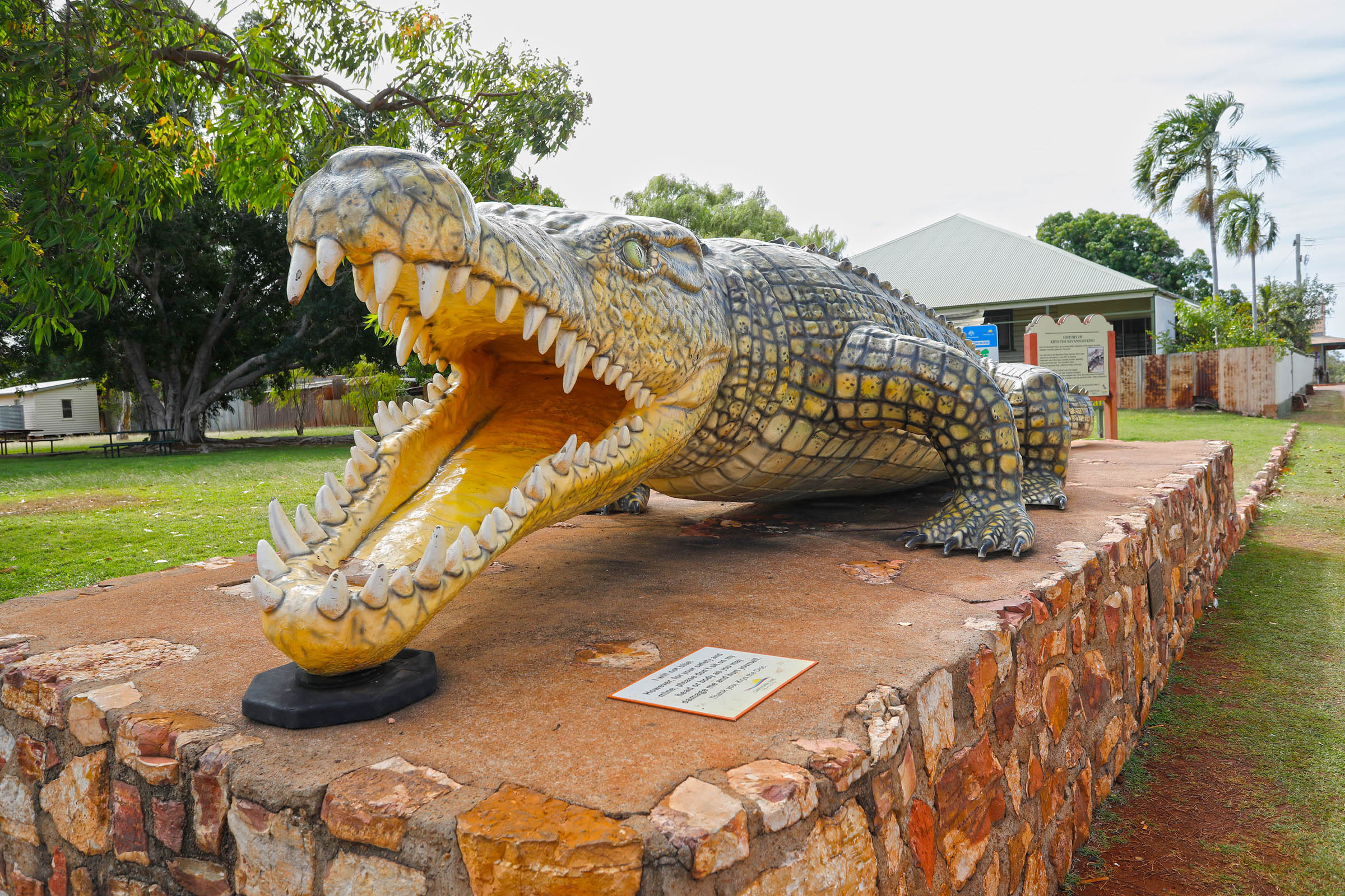
Normanton also has a couple of ‘big’ sculptures to impress visitors. One is ‘The Big Barramundi’, a fibreglass model standing 6m tall, built by Billy Miller in 1995 (a keen angler) to promote his motel and caravan park business. Bigger, and more fearsome still, is ‘Krys, The Big Crocodile’, a life-size replica (8.63m) of the largest crocodile ever shot in the Norman River, by professional hunter Krystyna Pawlowski in 1957.
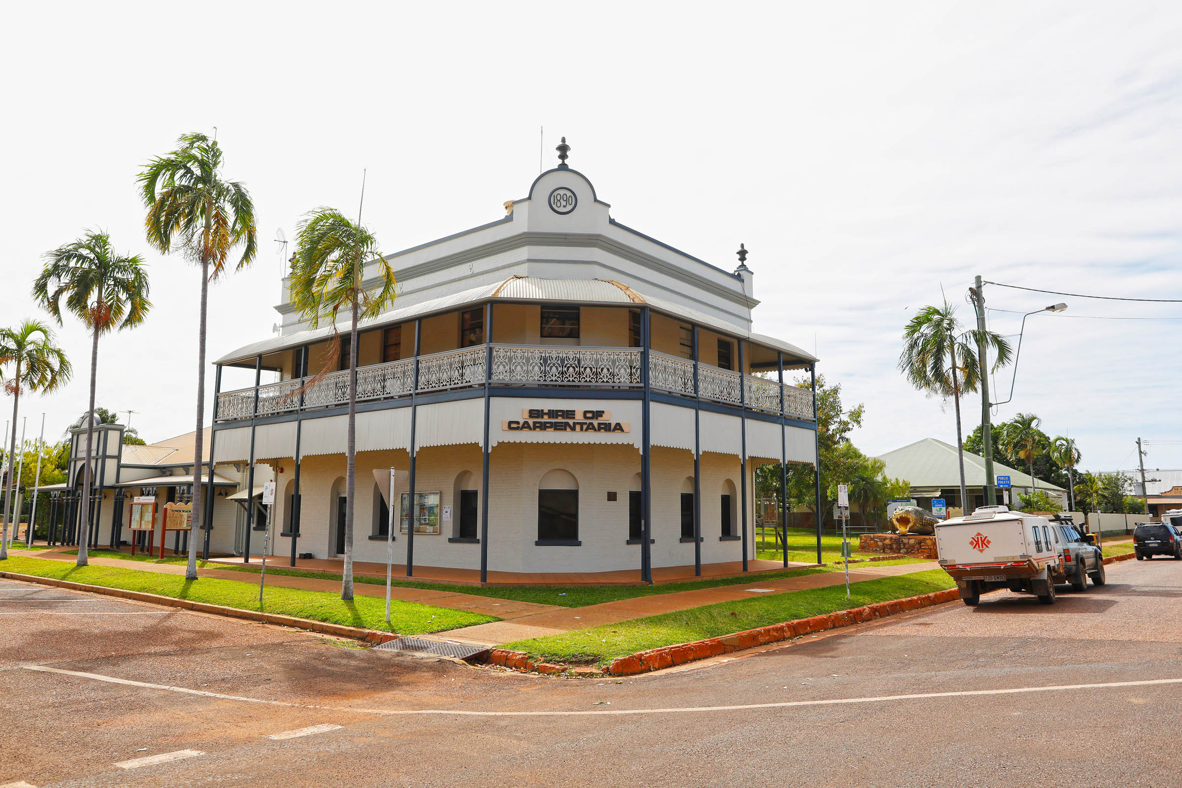
History buffs will enjoy the Town Walk, guided by a brochure from the visitor information centre, which lists 30 places of historic interest around town. Some of the more interesting and important sites include: the stylish Carpentaria Shire Council Building (1890); the Bank of New South Wales, now Westpac (c.1896); the Albion Hotel, a popular local pub, built in Croydon in the late-1800s and transferred to Normanton in the early 20th century; the National Hotel (aka the ‘Purple Pub’), one of the most photographed buildings in the town.
The large, warehouse-style Burns Philp Building (1884) operated continuously as a general mercantile store and agency office for more than 120 years and is the company’s oldest surviving store, now housing the visitor information centre and library. The Normanton Railway Station (1889) is a classic example of late-19th century railway architecture, and still serves as the terminus of the ‘Gulflander’ train service to and from Croydon, which operates between the town’s once a week.
Karumba
In the 1870s, a tiny settlement known as Norman Mouth was established around a telegraph station on the coast downstream from Normanton. During the gold boom at Croydon, the settlement was renamed Karumba (an Aboriginal word meaning 'spirit of an old man') and quickly developed as a supply point for vessels trading in the Gulf.
Although freight traffic declined after the closure of the Croydon goldfield, Karumba continued as a maritime outpost on this remote coastline by adding fishing to its commercial activities. A meatworks operated briefly in the 1930s, and a sheltered part of the river was used as a refuelling and maintenance base for Qantas and BOAC flying boats travelling between Australia and London. During World War II, the town was a busy base for Catalina long-range bombers operating over New Guinea, Timor and Indonesia.

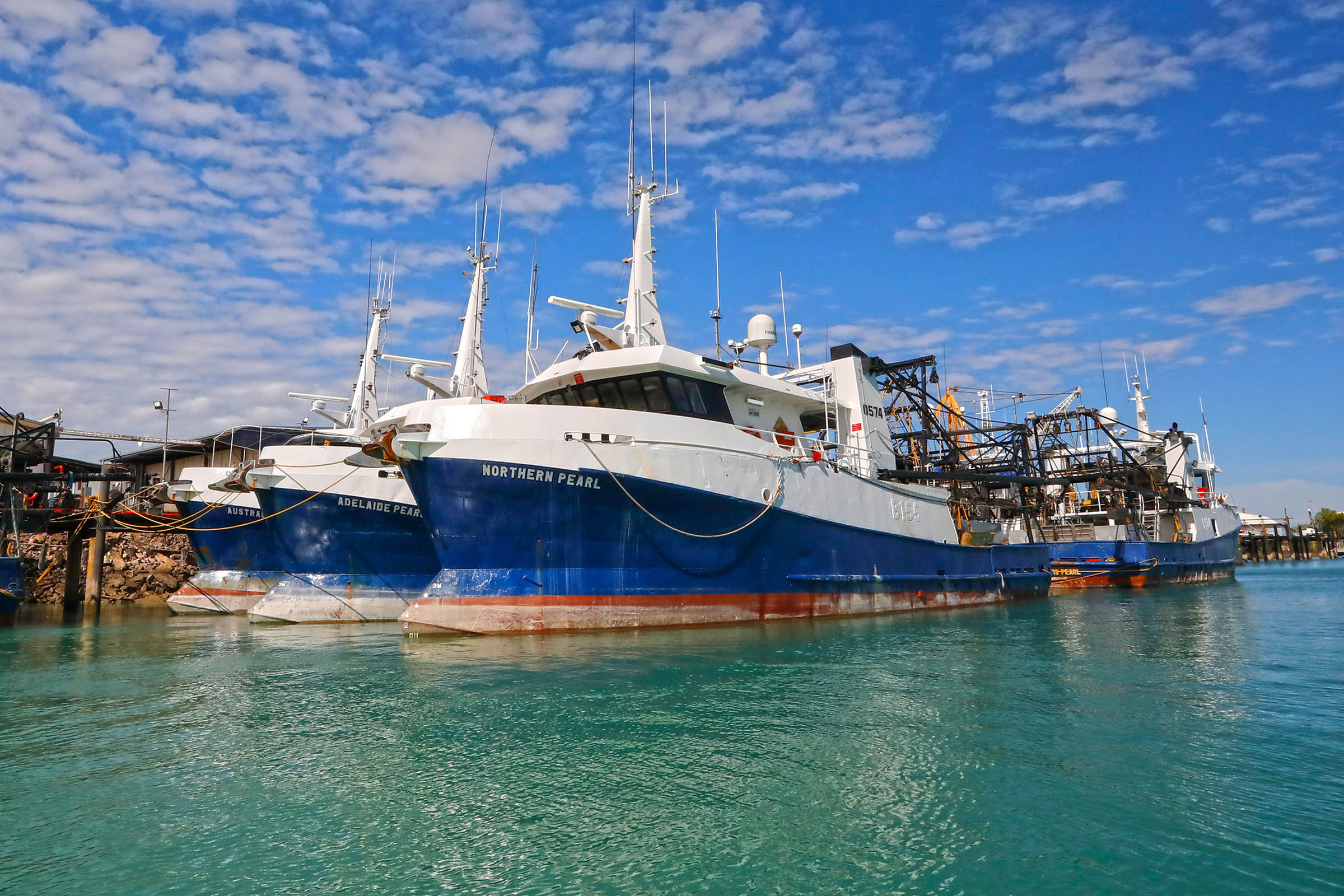
In the 1960s, prawn fishing and processing began at Karumba, and port facilities were developed for live cattle exports. Since the 1990s prawn processing has moved offshore, with 'mother' ships freezing the catch for direct transport overseas, and cattle exports have been discontinued. Nevertheless, Karumba remains the centre for the Gulf’s lucrative commercial fishing industry, earning an estimated $12 million each year targeting barramundi, mackerel and tropical sharks. A commercial mud crab fishery also operates in the estuaries and coastal waters, with an annual harvest of around 130 tonnes, representing 15 per cent of Queensland’s total catch.
In the late-1990s, the port was enlarged with facilities for processing zinc and lead ore from the MMG Century Mine at Lawn Hill. The ore is pumped from the open-cut mine in a slurry through a 300km underground pipeline to Karumba, where it is dried and packed for barge transfer to ships anchored in the Gulf.
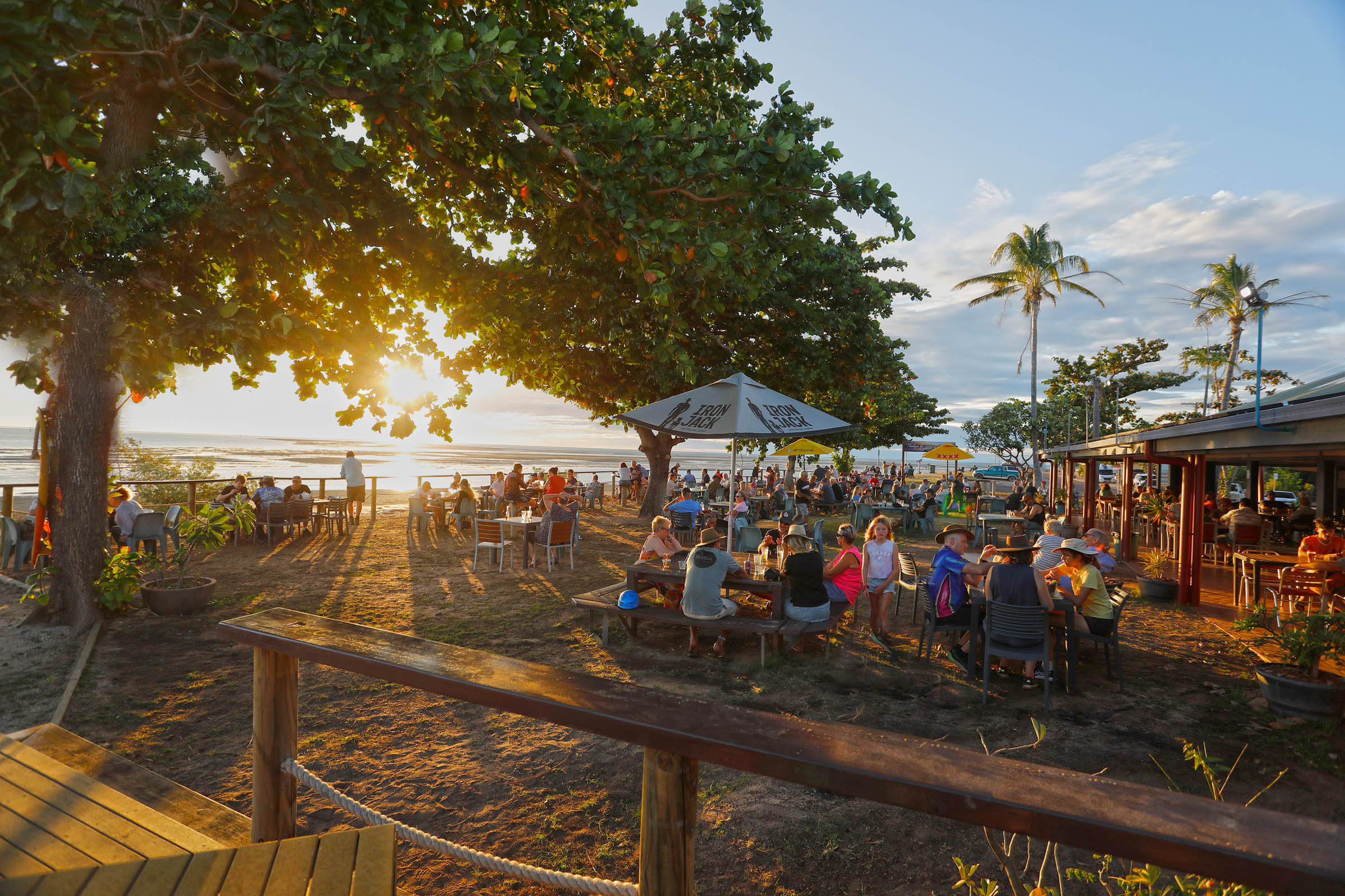
Present-day Karumba is a town in two interconnected, but quite distinct, halves: the tourist hub on Karumba Point, with its sandy beach, boat ramp, caravan parks and the popular Sunset Tavern overlooking the river mouth; and the industrial precinct and home port for the fishing fleet further upstream. An easy 3.5km walk (or bike ride) connects the two zones, passing through coastal and estuarine environments.
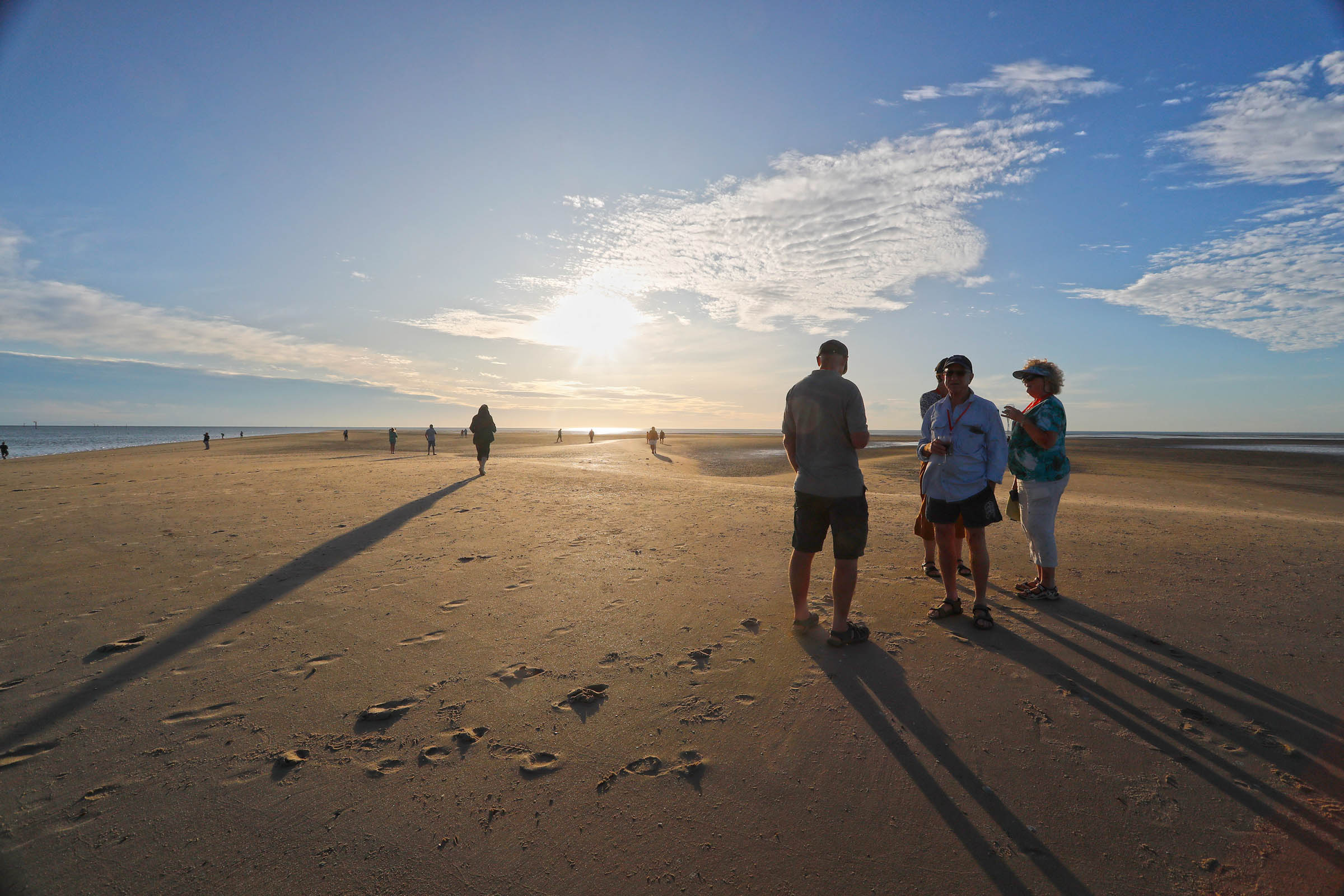
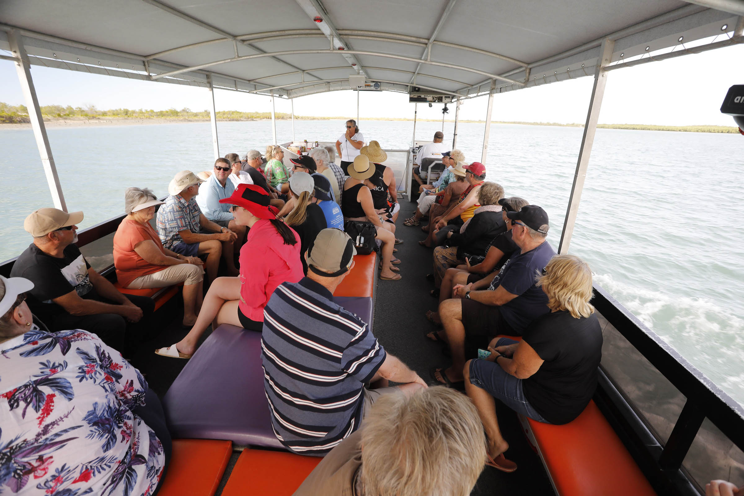
The town is a popular destination for recreational anglers, who migrate here in large numbers during the dry season and spend weeks or months fishing in the Norman River, mangrove-lined creeks and coastal waters. Target species include barramundi, threadfin, mangrove jack, fingermark bream, jewfish and mud crabs. There are several charter operators for recreational fishing and crabbing, as well as river cruises for birdwatching, croc spotting and tours of the port. An excellent outing is a cruise out of the river mouth to a sand island for a spectacular sunset happy hour.
Another major tourist drawcard is the Les Wilson Barramundi Discovery Centre, housed in an eye-catching, architect-designed building embracing a lagoon that serves as a barramundi hatchery – the only one in the world to breed the Southern Gulf strain of this iconic fish. The hatchery produces fingerlings that are eventually released back into the rivers. Admission is free to browse the exhibits and interactive displays that explain the habitats and lifecycle of this sought-after species. An in-depth guided tour is available to view the fish and take part in the feeding experience (fees apply).
Karumba also hosts the annual Outback by the Sea Festival (June-July), which features art workshops, live music, Indigenous culture programs, stargazing and twilight markets.
FAST FACTS
Barramundi Discovery Centre
149 Yappar Street, Karumba
P: 07 4745 2211
E: info@barracentre.com.au
Carpentaria Shire Council
29-33 Haig St, Normanton
P: 07 4745 2200
E: council@carpentaria.qld.gov.au
Crab and Croc Tours
40 Col Kitching Drive, Karumba
M: 0417 011 411
E: crocandcrab@bigpond.com
Gulf Country Caravan Park
69 Yappar Street, Karumba
P: 07 4745 9148
E: info@gulfcountrycaravanpark.com.au
Karumba Point Holiday Tourist Park
2 Col Kitching Drive, Karumba
P: 07 4745 9306
E: info@karumbapoint.com.au
Karumba Point Sunset Caravan Park
53 Palmar Street, Karumba
P: 07 4745 9277 / 0436 339 081
E: sunsetcp@gmail.com
Karumba Visitor Information Centre
149 Yappar Street, Karumba
P: 07 4745 2211
E: info@barracentre.com.au
Kerry D Fishing Charters
32 Col Kitching Drive, Karumba
P: 07 4745 9275 / 0427 459 275
Normanton Visitor Information Centre
Cnr Landsborough and Caroline Streets, Normanton
P: 07 4747 8444
E: tourism@carpentaria.qld.gov.au